The Germanic invasions of the 5th century destroyed the Western Roman Empire.
The fall of Rome, in 476 A. D. marks the beginning of the Middle Ages.
1. 1. The end of the Western Roman Empire.
In the early 5th century, a nomadic people from Asia, invaded Europe, led by their ruler Atila.
The Germanic peoples fled from the huns to the Western Roman Empire, invading it and creating various rival German Kingdoms:
The Ostrogoths: Italy and Dalmacia.
The Visigoths: south of Gaul and Hispania.
The Franks: Gaul
The Burgundians: eastern Gaul.
The Alemani: the Rhine.
The Angles and Saxons: Britannia.
1. 2. The germanic kingdoms.
The germanic peoples had no a writting language, laws or states. They
were organised in tribes, led by a warrior-king, elected by the chiefs
of the tribes.
Because of this, when they occupied a territory they became the ruling
class but adopted Roman customs. Latin was the official language,
Christianity the official reliigion and the kings had Roman counsellors
and used Roman money.
1. 3. Breakup of the Mediterrenan unity.
By the 8th century, the Mediterranen was divided in three different cultural and religious areas:
The Western Roman Empire controlled by the Germanic Kingdoms. Official language: latin; official religion:
The Eastern Roman Empire became hellenised and adopted the Greek language and eastern political practices.
In the 7th century, the followers of Islamc conquered many territories formely governed by Rome.
Empire of Attila the Hun.
Fall ot the
Western Roman Empire. File:Invasions_of_the_Roman_Empire_1.png
https://commons.wikimedia.org/wiki/User:MapMaster License: (CC BY-SA
2.5)
Portrait of
Theodoric the Great, a ostrogoth king. The barbarian kings represented
themselves as romans.
File:Estimated_image_of_Theodoric_the_Great_in_the_Basilica_of_Sant'Apollinare_Nuovo._Ravenna,_Italy.jpg
https://commons.wikimedia.org/wiki/User:%D0%92%D0%B2%D0%BB%D0%B0%D1%81%D0%B5%D0%BD%D0%BA%D0%BE
CC BY-SA 3.0
Aureus of Theodoric the Great. The germanic kingdoms continued to use the roman coins.
2. THE VISIGOTH KINGDOM.
The visigoths were a germanic tribe that became
mercenaries in the service of Rome and settled in Dacia in the 4th century.
In 409 AD several germanic peoples: the suevis, vandals
and alans invaded the Iberian Peninsula and the visigoths came to the Peninsula
as allies of Rome. They expeled the vandals and alans to Nort Africa.
By themiddle of the 5th century they formed a kingdom in
southern Gaul, the kingdom of Tolosa.
In 507 A. D., they were defeated by the franks (Battle of Voullie) and lost the south
of Gaul. After that they organised a kingdom in the Iberian Peninsula with
capital in Toledo that surived 200 years.
2. 2. Political organisation of the visigotich kingdom.
The Visigoths were a small minority (150.000 of a population of six
million), but hold most of the land and were the privileged social
group.
The visigothic kingdom was based on:
•An
elected monarchy but supported by institutions such as:
Aula
Regia, an advisory body of nobles and clergy.
Councils
of Toledo, religious and civil assemblies were laws were made.
•Control
of the entire Peninsula:
Conquered
the Suebi kingdom.
Conquered
the byzantine southern Spain.
Stopped
the franks in the north.
•Legal
and religious unification of the Visigoths and Hispano-Romans:
Repealing
the banning of mixed marriages.
Conversion
of Recared to Catholicism.
The
Liber Iudicorum (654), a single law for the kingdom.
3. VALERIO BECOMES A PEASANT.
3. 1. Decline of the cities.
By the 5th century cities in Western Europe declined and
started to loss population, because of three factors:
the attacks of
the Germanic tribes
the reduction of the trade
the lack of jobs.
Many people decided to leave the cities and live in the
countryside, working a plot of land in order to obtain food to eat.
3. 2. Apparition of servitude.
Only wealthy lawowners had armies and fortress to protect themselves,
because of that many peasants agree to become serfs .A serf was a
peasant that work the lands of a lord in exchange for protection.
3. 3. Ruralisation.
The peasants that fled the cities formed villages surrounded by
palisades. They worked the land and kept domestic animals. They produce
almost every they needed, becoming self-sufficient.
4. VISIGOTHIC ART AND CULTURE.
In the visigoth kingom took place a cultural fusión between
the Hispano-Romans and the Visigoths.
4. 1. The importance of the Church.
The clergy was very important because they knew how to write and read:
Became the greatest conservers of Roman Culture
Worked as a advisers to the monarchs.
The Visigoths were Arians, they believed that Jesus was not the
Son of God but was human, but they converted to Christianity in the 6th century.
In Toledo were held councils, assemblies of bishops called by the king in which civil and religious issues were discussed. Council resolutions were passed by the king and became laws.
4. 2. The scholarly language: latin.
Latin was the language of the written language of the
Visigothic Kingdom and many works of Greco-Latin antiquity were copied in
Christian monasteries.
4. 3. Art.
Characteristics:
The main characteristics were:
The fusión of Roman tradition with Germanic
influences.
The importance of religious art.
Architecture
Small churches with stone walls and very few windows.
Use of materials from Roman buildings.
Use of basilica floor plan an corinthian capitals.
Use of horsehoe archs.
Metalwork.
Metalwork was the most important artistic expresion:
Precious metals (gold and silver), bronze and iron.
Use of varios techniques: casting, engraving, gilding, inlays.
Use of irregular pearls.
Recesvinto's crown. Archaeological Museum of Madrid.
Votive cross, Guarrazar's treasure. An example of a jewel with inlays.
Bronze visigoth brooch. Fichier:Fíbulas_aquiliformes_de_Alovera_(M.A.N._1975-49-130-53589)_01c.jpg Attribution: Larry Wentzel CC BY-2.0)
5. THE BYZANTINE EMPIRE.
After the fall of Rome, the Eastern Roman Empire survived and became the Byzantine Empire.
Its capital city was Constantinople, founded in 330 A.D. by
the emperor Constantine on the Bosphorus Strait. Was surrounded by walls and
had about 500.000 inhabitants.
5. 1. The age of Justinian (527-565 AD)
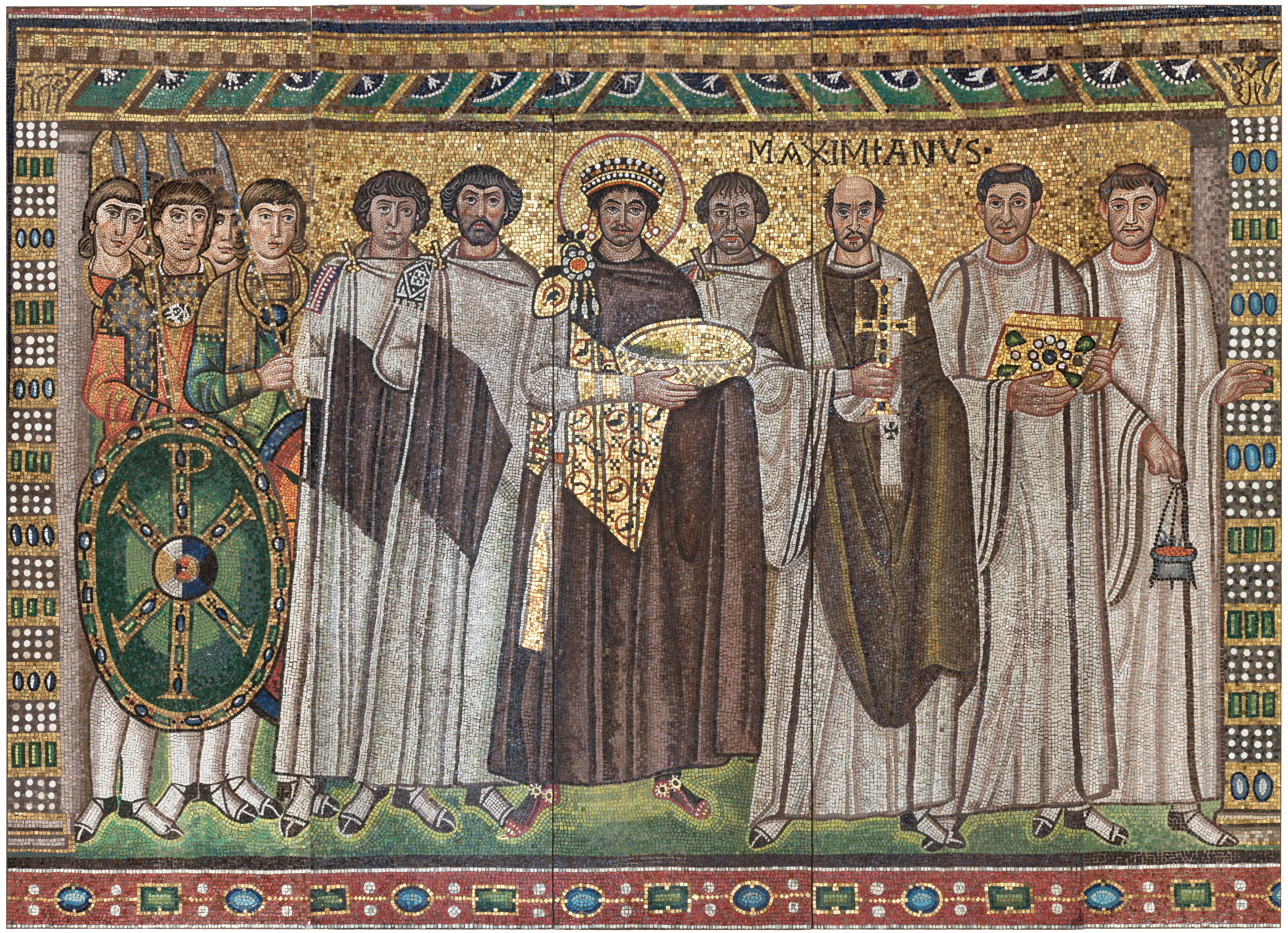
The most important ruler of the Byzantine Empire was Justinian (in spanish, Justiniano) who wanted to restore the Roman Empire.
Justinian recovered some provinces of the Western Roman Empire: the Dalmatian Coast, Italy, the Balearic Islands
Justinian compiled a collection of Roman laws, the Justinian Code.
5. 2. The easternisation of the Empire.
7th and 8th centuries:
The Empire lost a large part of its territories.
Greek became the official language of the Empire.
9th and 10th centuries (the second Golden age of
Byzantium):
The empire recovered a part of its territory and
the economy recovered.
The emperor (basileus) was considered the head
of Christianity
The Western (Catholicism) and Eastern (Orthodox)
Churchs broke up, due to the differences between religious ceremonies and the
rejection of the autorithy of the Pope. (1.054 AD)
The Orthodox Christianity and Byzantine culture spreaded among the Slavs (Bulgarian, Serbs, Russians), using the Cyrillic alphabet inventd by two monks Cyril and Methodius.
5. 3. The decline of Byzantium.
From the 11th century, Byzantium started to fall apart as a result of:
economic decline.
attacks of the Turks.
Finally, in 1453 AD, the Turks conquered Constantinople.
5. 4. Byzantine art.
Byzantine art was a mixture of Greco-Roman and eastern art.
Architecture:
Use of classical features (columns, archsm domes) and materials (brick, stone, marble).
Use of richly-coloured materials to decorate the walls.
The most important byzantine momument is the cathedral of Hagia Sophia.
Painting: Icons, religious images painted on wooden panels and brightly colored.
The Byzantine
Empire under Justinian.
File:The_Byzantine_State_under_Justinian_I-es.svg Author:
https://commons.wikimedia.org/wiki/User:Neuceu Lincese: (CC BY-SA 3.0)
The Byzantine
Empire in the middle 9th century. File:Byzantine_Empire_842_AD.png
Author: Author: https://commons.wikimedia.org/wiki/User:Neuceu Lincese:
(CC BY-SA 3.0)
The Byzantine Empire in 1025 AD. File: https://upload.wikimedia.org/wikipedia/commons/0/0b/Byzantine_Empire_1025_AD.png Author:
Ichthyovenator License: (CC BY-SA 4.0)
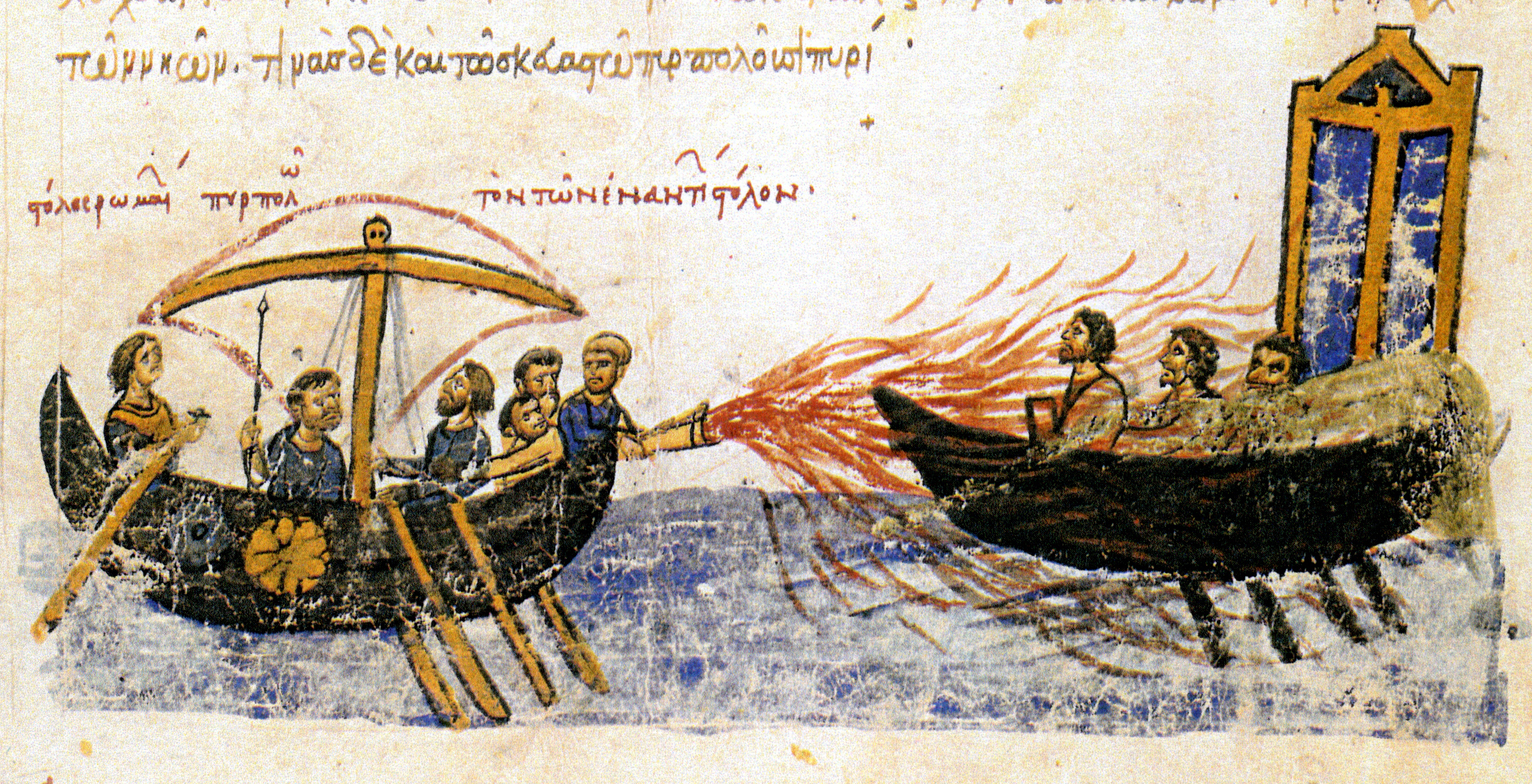
A Byzantine ship
using the greek fire. The greek fire was the secret weapon of the
Byzantine army. It was a mixture of flammable substances that could be
use in flamethrowers or hand grenades.
Map of the different alphabets used in Europe.
6. THE CAROLINGIAN EMPIRE.
6. 1. The Frankish kingdom.
The frankish kingdom included modern-day France, and
territories in Italy, Switzerland, Germany, Belgium and Holland.
In the early 7th century, a
frankish noblemen, Charles Martel defeated the muslims in Poitier (732).
His son, Pipin the Younger,
became King of the franks and founded the Carolingian monarchy.
His sucesor, Charles the Great
(Charlemagne) conquered most of Western Roman Empire.
6. 2. Charlemagne.
Charlemagne was important because he:
Conquered a large part of Western Europe: securing the borders of the empire.
Strengthened the union between political and religious power:
Force everyone to convert to Christianity.
Force the bishops to declare their loyalty to him.
He was crowned emperor by Pope Leo III in 800 A. D.
6. 3. The carolingian renaissance.
Charlemagne began a cultural revival: the Carolingian Renaissance.
He established schools.
He reintroduced the teaching of Latin.
Monks copied the works of Greco-Latin writers.
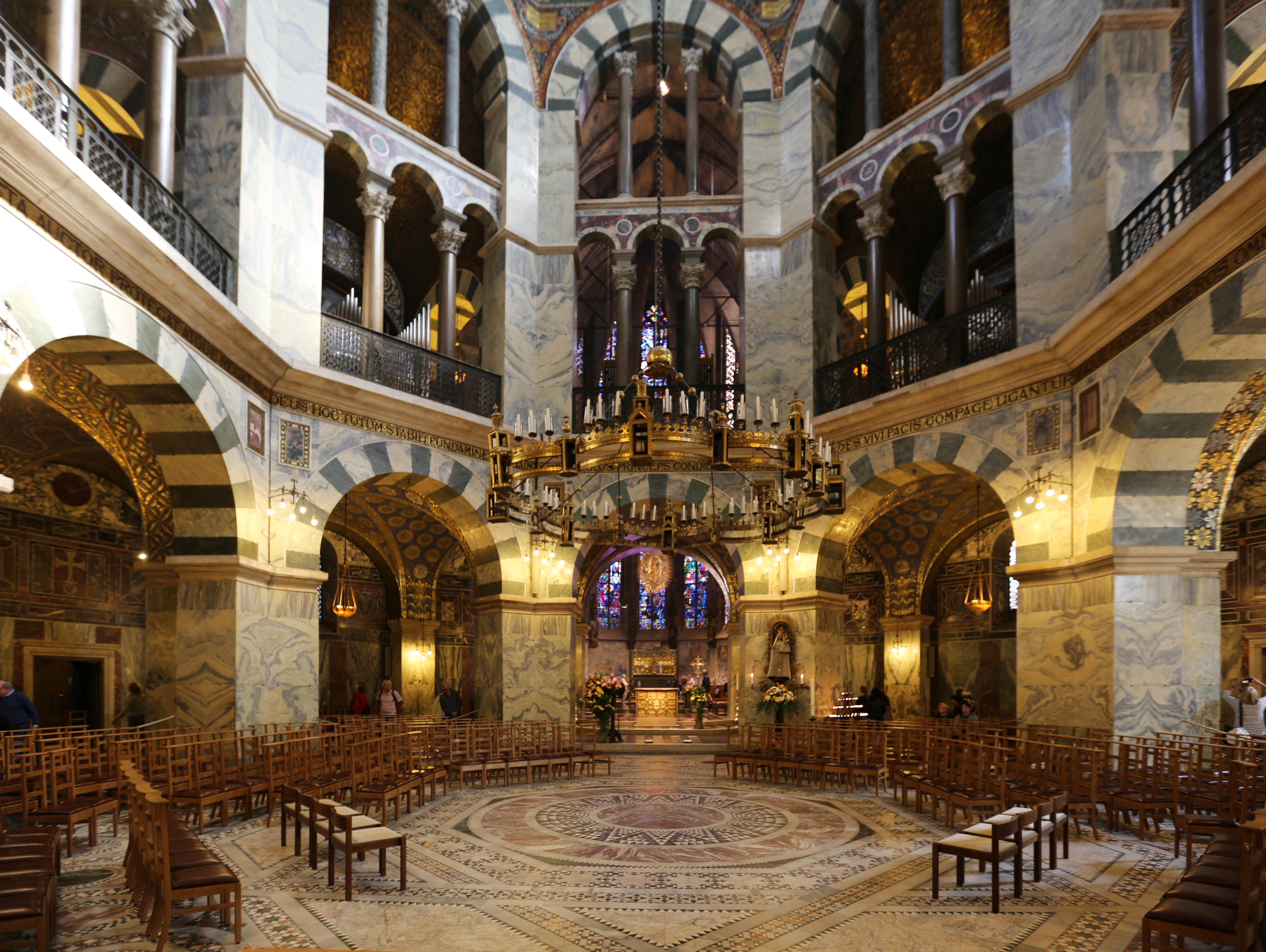
Palatine Chapel,
the only surviving part of the Charelamgne's palace in Aachen. It has a
heigh of 30 meters and a width of 16 meters.
File:Aachen,_Innenarchitektur_der_Pfalzkapelle.jpg
https://commons.wikimedia.org/wiki/User:HOWI CC BY-SA 3. 0
Signature of
Charlemagne. Charlemagne did not learn to write and read until old age
and his handwriting was poor during all his life.
7. HOW DID CHARLEMAGNE GOVERN HIS EMPIRE?
Charlemagne created a new way to governing his empire because:
7. 1. Organisisg the empire.
In order to govern his empire, Charlemagne gave land to the nobles in order to administer it on his behalf:
The empire was divided into 250 counties, led by a count, a landowner appointed by the emperor who collected taxes and recruited soldiers.
The border areas, marcas, were led by a military commnader, a marquis.
A corps of loyal commissioners, missi dominici, was established to enforce laws and control the counts and the marquis.
These posts were not inherited and the emperor could remove a noble from office.
The nobles (counts and marquis) and the clergy had to meet with Charlemagne in court once a year.
7. 2. Personal loyalty.
The system of goverment of the carolingian empire was based in a chain of personal relationships based on two principles:
loyalty: the nobles became the vassals and swore loyalty to the emperor, promisin respect and military aid.
protection: the emperor granted them lands and the right to govern them.
The counts and marquis received a oath of allegiance from lesser vassals and gave them lands in return.
7. 3. The birth of feudalism.
After the death of Charlemagne, this system of goverment changed because of two factors:
Division of the empire. After the death of Charlemagne's son, Louis the Pious, there were a civil war between his sons. Finally, they signed the Teatry of Verdun (843 AD), dividing the empire in three parts:
Charles the Bald received the kingdom of Western France.
Lothar, the kingdom of Middle France and the title of emperor.
Louis the German the kingdom of Eastern France.
The 9th century invasions (vikings, magyars, saracens, etc.)
caused terror and insecurity among the population and only the local
lords could protect them because there was not a central power.
As a result, the counts and marquis became practically independent and the kings had only a theoretical power.
Map of theTeatry of Verdun. File:Treaty_of_Verdun_-es.svg User:Trasamundo License: CC BY-SA 3.0
Life in Ancient Egpyt was possible thanks to the waters of the Nile.
The
source of the Nile is in Equatorial Africa, and runs through a narrow
valley and flows into the Mediterranean Sea. We can divide the Nile in
two natural regions:
The Upper Egpyt, the valley.
The Lower Egpyt, the delta.
Every summer the river's water level rose and flow the valley.
When the waters retired, them left a thick layer of fertile slit perfect
for agriculture.
1. 2. The origins of the egpyptian civilization.
Around 5.000 B. C., the neolithic settlements along the Nile river learnt how to predict tha nnual river flooding. They:
undertook drainage works.
built irrigation channels
learnt to use slit as natural fertiliser.
Because of this, settlements became independent cities ruled by nomarchs.
In 3.100 B. C., the legendary king Nemes unified the territories of Lower and Upper Egypt.
1. 3. The historical periods.
We can divide the history of Ancient Egypt into several periods separates by intermediate periods of decline:
Old kingdom (3.100-2181 B. C. ). The capital was Memphis and they built the pyramids.
Middle kingdom (2.055-1.795 B.C.). The capital was Thebes and Nubia was conquered.
New kingdom (1.550-1.069 B. C. ). They conquered Syria and
Palestina. Egypt was ruled by famous pharaophs such as: Akhenaton,
Tuthankamon and Ramses II.
Late period (715-31 B.C.) Egpyt was conquered foreing peoples such as the assyrians, the persians and the greeks.
Geography of Egypt.
The Nile river.
Ancient Egpyt geography.
Another video about the geography of Ancient Egypt.
The Nile river.
The major regions of Egypt.
2. Social and political organisation.
2. 1. Political organistaion of society.
The egyptian king was
called pharaoph. He was considered a living god, the early encarnation
of Horus, the god of sky and had political, military and religious
powers:
As a king he:
made laws
inspected hydraulic works.
owned most of the land of Egypt.
controlled the collecting of taxes.
As military leader led the army.
As religious leader he ordered the construction of temples to worship the gods.
He had several attributes that symbolized his powers:
The two crowns:
The white crown of the Upper Egpyt.
The red crown of the Lower Egypt.
The crook and the flail:
The crook, which symbolized the power of the pharaoph over his subjects.
The flail, which symbolized his duty to destroy the enemies of Egpyt.
The false beard, a symbol of inmortality.
The uareus, a symbol of the protection of the gods.
2. 2. A very hierarchical society.
The egyptian society was divided into several groups:
The upper strata included the pharaoph, the pharaoph's family, the nobility and the priests. They owned most of the lands:
The nobility controlled most of senior roles in the administration and the army.
The priests were in charge of worshiping the gods and manage the lands of the temples.
The intermediate strata included:
wealthy merchants
specialised artisans
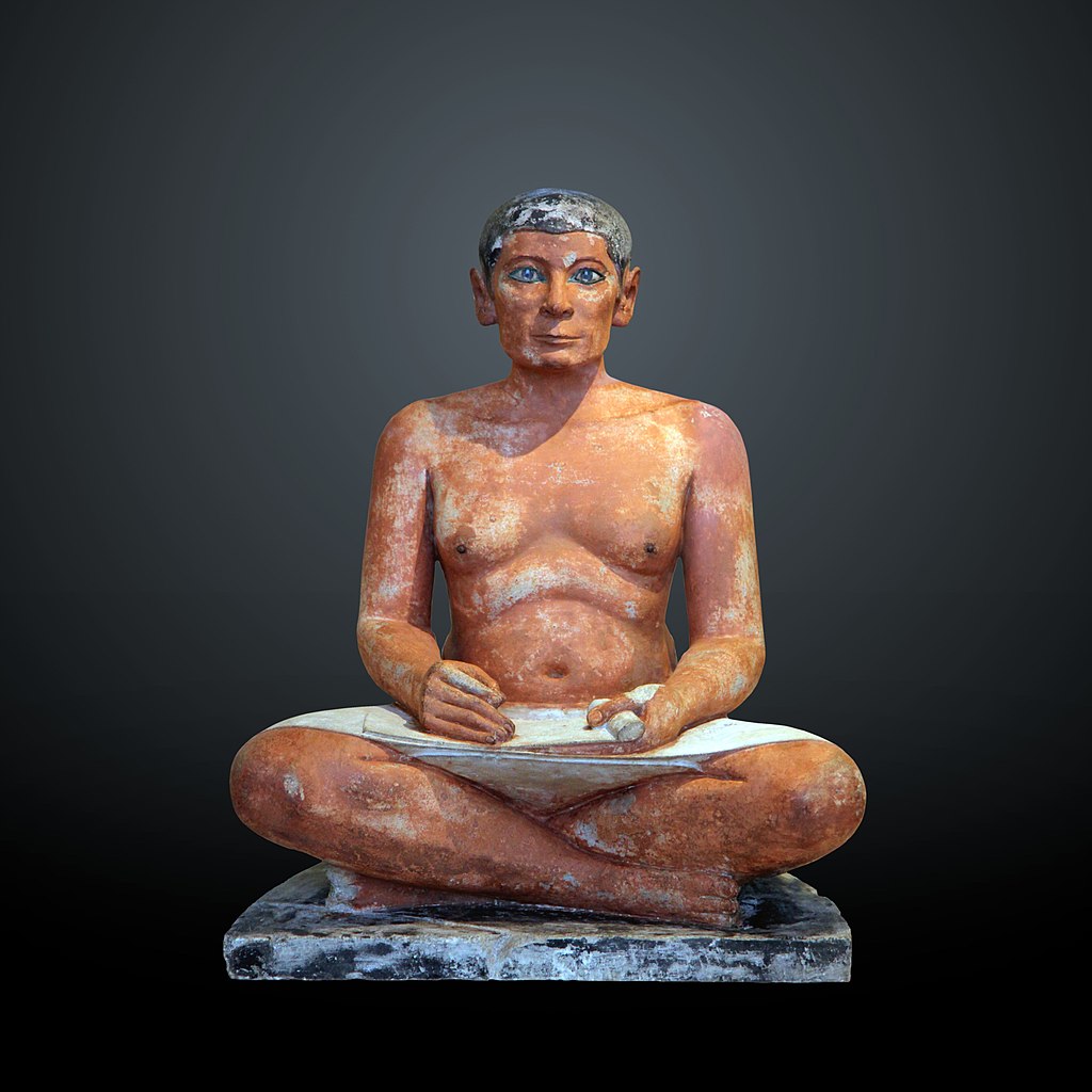
scribes, people that knew how to read and write. They carried out roles in temples and palaces.
The lower strata that included free people:
peasants that worked for the nobles or the temples.
small-scale merchants.
artisans
soldiers.
3. The egyptian economy.
3. 1. Irrigation-based agriculture.
The main economic activity was irrigation-based agriculture. There were three seasons:
Sowing (october to january). The water level dropped and the peasants sowed the fields with seeds.
Harvest (february to may).The crops were harvested with wooden scythes during the dry season.
Flooding (june to september). The water level rise and the banks of the river were flooded.
They also used a extensive network of irrigation channels.
The main crops were wheat and barley that were used to make bread and beer. Other crops were linen, papyrus, olives and fruit trees.
The
lands were a property of the pharaoph and were worked by the peasanst
who had to pay tributes. Also they had to work building dykes, canals,
temples and pyramids.
3. 2. Other economic activities.
Livestock farming: cows, donkeys, sheeps and poultry (in spanish aves de corral).
There were many artisans in the cities: stonemasons, carpenters, potters, weavers, etc.
Agriculture and seasons.
Domesticated animals.
4. Daily life.
4. 1. Egyptian dress.
We know what the Egyptians wore from the remains found in tombs or from reliefs and paintings, but most of them represented the pharaoph and the nobility.
Upper class men wore a wrap-around skirt that reached the knees and was fastened at the waist. Whereas workers wore a linen loincloth
Women wore a long tigh-fitting tunic that reached down to their ankles.
Ancient egyptians would shave their bodies and used wigs. Egyptian women bathed frequently, wore eye make-up and used body lotions and perfumes.
4. 2. Dwellings.
Egyptian houses were built of adobe walls made with clay from the Nile.The roof was made of palm tree trunks tied together and bound together with a layer of clay. The roof was used for storage puroposes and for slepping on hot nights:
The poorest houses had only one floor and little forniture.
The houses belonging to the nobilty had two floors, rooms for servants and gardens woth palm trees and ponds. vivían en viviendas de dos plantas con habitaciones para los criados.
Ancient Egypt's medicine.
The egyptian household.
Fashion of Ancient Egypt.
5. Egyptian religion.
5. 1. The Egyptian gods.
The main characteristics of the egyptian religion were:
It was polytheistic religion: they believed in many gods.
Gods were represented with human and animal features.
A number of animals were considered to be sacred such as scarab bettles, cats, cows and cocodriles.
They use amulets to evade evil spirits
The main gods were:
Amun-Ra, the Sun god.
Horus, god of the sky.
Anubis god of mummyfication.
Hathor, goddess of love.
Isis, wife of Osiris and goddes of fertility.
Osiris, god of the dead.
5. 2. Judgment of Osiris.
Egyptians believed in life after
death. In order to obtain it, the decesaded has to pass the Judgment of
Osiris. The heart of the deceased was placed in one side of a set of the
scales an in the other the feather of the goddes Maat who simbolised
justice. If the person was free of guilt the heart would weight less
than the feather and the deceased would be rewarded with eternal life,
but if the heart would weight more than the feather he would be devoured
by a demon (Ammit).
The Book of the Dead was a set of formulas to assist the decesased on the journey to the afterlife.
The myth of Osiris.
Mummification.
How to make a mummy.
The book of the dead.
6. The cultural and artistic legacy.
6. 1. The hieroglyphic script.
Writing language appeared in Egypt in 3.250 B. C.
They used a hieroglyphic script with the following characteristics:
It used drawings to express sounds, words or ideas (pictograms).
Was used for officials or religious texts.
Usually inscribed on stone or painted in walls.
A symplified version (hieratic) was used for writing on papyrus, fabric or wood.
6. 2. Architecture.
The main characteristics were:
Buildings were made of stone.
Had flat roofs supported by a lintel and columns
Buildings were decorated with murals and sculptures.
The main types of buildings were temples and tombs.
a) Temples were divided in several parts:
Avenue of the Sphinxes, where ceremonial processions entered the temple.
pylon, a huge wall located at the sides of the main entrance.
the courtyard, an open space surrounded by columns.
hypostyle hall, a covered space with columns in which the people couldn't enter.
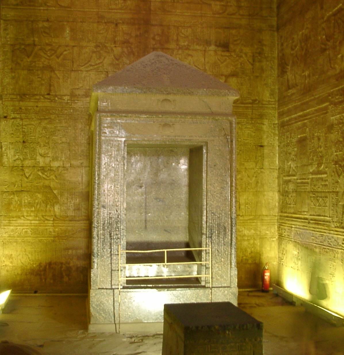
the sanctuary, where the statue of the god was kept in the dark.
b) Tombs Tombs were built to ensure the eternal rest of the pharaophs, their families and other privileged groups. Tombs were decorated with scenes from everyday life and the Book of the Dead. Also funerray objects were placed in the tombs.
We can distinguish several types of tombs:
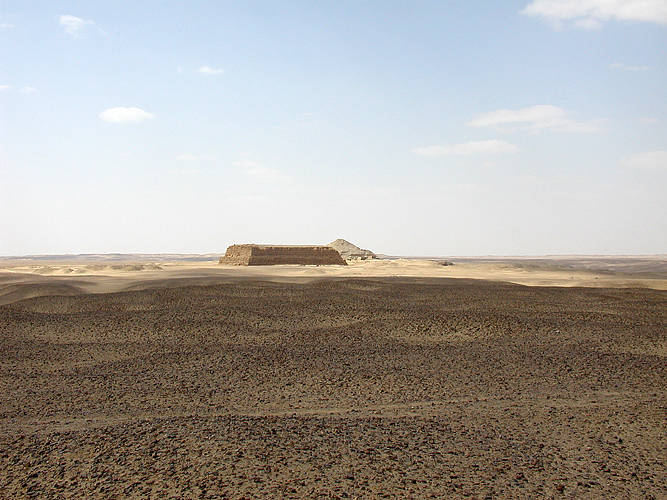
First, they built mastabas, simple, low rectangular structures with an underground burial chamber.
Later, they started to build pyramids, colossal structures
with a rectangular base. Apart from the pharaoph's burial chamber,
contained several false burial chambers and
Finally, they built hypogea
Sculpture.
The main characteristics of the egyptian sculpture were:
Were made in stone.
Included statues and reliefs.
They represented:
idealised pharaophs and gods on a large scale.
nobles and scribes in a more natural manner and a smaller scale.
Painting.
Were used to decorate the walls of the temples and the interior of temples.
Frontalism: In paintings and reliefs, faces were shown in profile with the torso facing forward.
More important figures were larger than other figures.
File:Egyptian_Hieroglyphic_Alphabet_001.jpg Autor: User:لا_روسا&redirect=no License: CC BY-SA 4.0)
Gyza pyramid
cmplex, from left to right: Khufu's pyramid (in spanish, Keops),
Khafre's pyramid (in spanish, Kefren) and Menkaure's pyramid (in
spanish, Micerinos).
Originally, the sides of the pyramids were completely smooth, because them were covered with slabs of polished stone.
An example of hypogea, the funerary temple of Hatshesup.
The interior of the tomb of Taousertet and Sethnakht in the Valley of the kings.
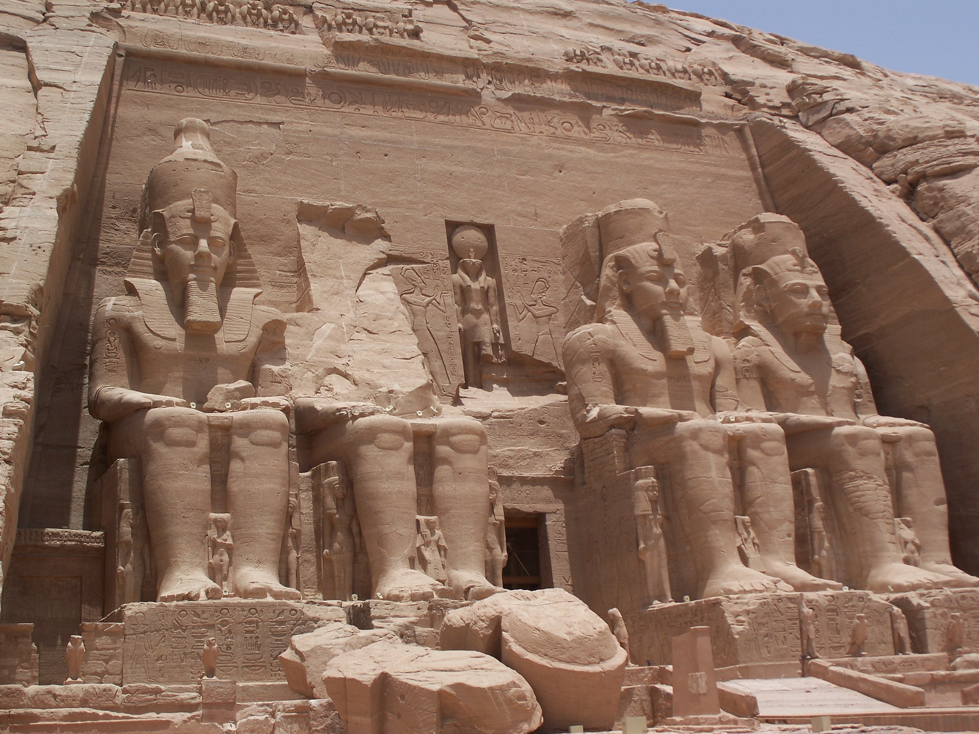
Sculptures of Ramesses II in the temple of Abu Simbel.
Frontalismo: el cuerpo y la cabeza se representa de perfil mientras que los hombros y los ojos aparecen representados de frente.
Spoken ancient Egpyt (numbers, gods and hieroglyphs).
HERE YOU HAVE A PART OF THE CONTENTS THAT ARE GOING TO BE A PART OF THE NEXT EXAM. REMEBER THAT YOU ALSO HAVE TO STUDY A PART OF THE UNIT 7. THE PREHISTORY.
1. THE ATMOSPHERE AND ITS CHANGES.
1. 1. Functions and composition of the
atmposphere.
Atmosphere: gaseous layer that surrounds the
Earth.
Composition: is made up of water vapour and a
mixture of gases:
nitrogen, 78%
oxygen, 21%
ozone.
carbon dioxide.
Its makes
life on Earth possible because:
it provides gases that are essentials to life
(oxygen).
it protects the planet from the impact of
meteorites.
1. 1. Atmospheric phenomena. Weather and
climate.
We have to distinguis
between the atmospheric weather an the climate.
Atmospheric weather is
the state of the atmosphere over one place at a specific time. The weather is changeable and can
be different every day. This is because the troposphere is
divide into large air masses that are moving continuously over the Earth's
surface.
The science
that study the weather is meteorology.
The climate is the
average state of the atmosphere over one place during a long period ot
time. It is calculated observing the succession of types of
weather for at least thirty years. Is more stable than weather.
The science that study the various types of climate is climatology.
2. THE ELEMENTS OF CLIMATE (I) TEMPERATURE AND PRECIPITATION.
2.1. The elements of climate.
Elements of climate: components of the atmosphere that can be measured. The
main are:temperature, precipitation atmosheric pressure and wind.
Temperature and its factors.
Definition: temperature is the amount of heat in the
air. It is measured in degrees Celsius (Cº), using a thermometer.
Temperature
is determined by the following factors:
Latitude. Between the Equator and the Tropics the
temperature is always high because the rays of the Sun reach the Earth
surface almost perpendicular, while in the Poles the solar rays reach
the surface with an oblique angle.
Altitude. The temperature drops 0.6ºC for every 100 metres
above sea level, because the air is less dense and due to this conserves
less heat.
Distance from the sea. The sea waters change its
temperature slower than the land, because of that temperatures are milder
on the coast.Distance from the sea.
Also, we can
distinguish different latitudinal thermal zones:
One torrid zone,
between the Equator and the Tropics.
Two temperate zones,
between the Tropics and the Polar Circles.
Two frigid zones,
around the Poles.
Isotherm: imaginary lines that connect
locations with the same temperature in map.
Precipitation and its factors.
Precipitation: water that falls on the Earth's
surface from the clouds, either in liquid (rain) or sold (snow and hail) forms.
It is meassured with a pluviometer and it is calculated in milimetres
(mm).
There are several factors that
determine precipitation:
Latitude. Precipitation levels are
higher at the equator.
Altitude and terrain. Precipitation
levels rise in
relation to increase of altitude.
Distance from the sea. Precipitation
levelsare
higher on the coast because the sea is a constant source of humidity.
3. ELEMENTS OF CLIMATE (II). ATMOSPHERIC PRESSURE AND WIND.
3. 1. Atmospheric pressure and its factors.
Definition.
Atmospheric pressure is the weight of a column of air
on a place. It is meassured with a barometer and is expressed as millibars
(mb).
The average atmospheric pressure meassured at sea level it is 1.013
mb, but the atmospheric pressure changes and it is higher or lower in
different areas because of two factors:
altitude,
the higher the altitude, the smaller the volume and weight of the column
of air over a location becomes.
air
temperature:
cold air is denser and
heavier, so its tends to fall. As a consequence, its warmed and produces
dry and estable weather, and zones of high pressure known as anticyclones
warm air is lighter and less
dense, so it tends to rise, then cools and produces precipitation. As a
consequence produces zones of low pressure known as depressions.
Weather maps.
A weather
map is a chart that represent meteorological conditions over a specific area at
a specific time. In a weather map appear the following elements:
isobars, lines that connect all the points of equal
atmospheric pressure.
anticyclones are represented with a capital A (usually are
also represented with an H, high pressure). The wind moves between the
isobars from left to right in the northern hemisphere and from right to
left in the southern hemisphere.
depressions are represented with a capital B (usually
are also represented with an L, low pressure). The wind moves between the
isobars from rigth to left in the northern hemisphere and from left to
right in the southern hemisphere.
fronts, areas of contact between two air massess with
different characteristics. Can be:
hot fronts, represented with a red line
with semicircles.
cold fronts, represented with a blue line
with triangles.
Occluded front, represented with a red line
with semicircles and triangles (is the meeting of a hot and a cold front).
In this case, the front is about to dissapear.
Wind and its factors.
Wind is the horizontal movement of air.
Measurement:
its speed is
measured in kilometres per hour (km/h) or in metres per second (m/s),
using a anemometer.
its direction is
determined by the cardinal point of the source of the wind: east wind,
north wind. Is measured using a weather vane.
Wind is caused
by the difference in atmospheric pressure. The wind blows from areas of high
pressure towards areas of low pressure.
On Earth we
are going to find:
constants winds that maintain an equilibrium of temperatures,
transporting hot air towards the cold zones and vice versa. The most
important are thetrade winds (in
spanish: alisios) which goes from the Tropics to the Equator, the west winds and thepolar winds.
seasonal winds, such as the monsoons
(in spanish: monzones) in South East Asia
daily winds, such as marine and mountains breezes (in spanish: brisas).
4. THE BIOCLIMATIC ZONES. VEGETATION.
The climate and climatic zone.
The
combination of the temperature, precipitation, amospheric pressure and wind
creates the different climatic zones. A climatic zone is a division of
the climate of the Earth according to average temperatures and average rainfall
(precipitation level). We can distinguish the following climatic zones:
Torrid zone, which includes the equatorial and tropical
climates.
The northern and southern temperate zones, which includes the
mediterranean, oceanic and continental climates.
The northern and southern frigid zones which includes the polar
climates.
Also appear
azonal climates that can be found in different regions: deserts and mountains.
Vegetation and biosphere.
Vegetation: is the entire range of plant life
in an área. It is a part of the biosphere.
Biosphere: is the combination of all
living beings on the planet and the enviroment they live in. It is formed
by the troposphere, the Hydrosphere and the litosphere.
The main characteristic of the biosphere is its enormous diversity of plant and
animal species (biodiversity). Plants are organised in vegetal formations.
A vegetal formation is the combination of
plants in a región that are similar in size of characteristics. We can
distinguish three types of vegetal formations:
Forest areas are formed by trees. A
tree is a plant which has a clearly defined trunk and is
tall (usually more than 8 metres of height).
Scrubland consist of bushes. Bushes are smaller than trees
and have not trunk. Its branches divide at ground level.
Grasslands consists of grasses.
The
distribution of the vegetation is conditioned by numerous factors:
the relief
the soil
the climate (humidity, light, temperatura and
wind).
The Earth's bioclimates.
Earth is
divided in several bioclimatic enviorments or bioclimates. A bioclimate
is a extensive región characterised by its own climatic features and
vegetation. We can distinguish three major bioclimates: